Heavy rains, flash flooding soak southern fifth of Minnesota
The elements for a strong thunderstorm line – a brew waited for in anticipation all of Saturday, July 16 – eventually stewed together in northern South Dakota and west-central Minnesota during late Saturday afternoon, and moved through southern Minnesota late at night into the early morning hours of Sunday, July 17.
All told – depending on location, location location – rain totals ranged from four-to-five inches, causing flash flooding, rainfall-sogged fields and water-filled basements. Hail and strong winds were noted around Marshall, but as the system swept its way south and east, heavy rain, lightning and thunder were the features.
Locally, rainfall began approximately 10:30 p.m. and continued until 3 a.m. Windom Municipal Airport reported 1.77 inch of rain fell from 12:14 a.m. to 12:34 a.m., topped by 2.22 inches recorded during the 20 minutes from 12:34 a.m. to 12:54 a.m.
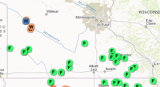
NATIONAL WEATHER SERVICE map showing reports of severe weather in the past 24 hours. Note the many “F” dots reflecting the flash flooding that occurred in the southern fifth of the state.
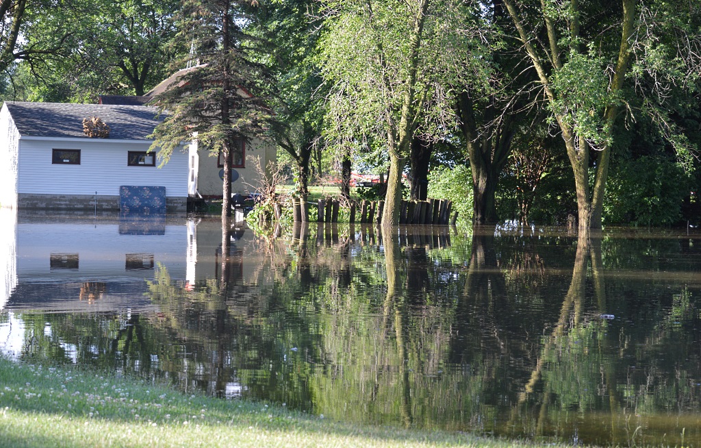
ON A SUNNY Sunday morning, the reflections of trees were captured in still water. However – this is not a lake scene – but a property owner’s back yard on the west side of Mountain Lake, between 3rd Avenue and 4th Avenue.
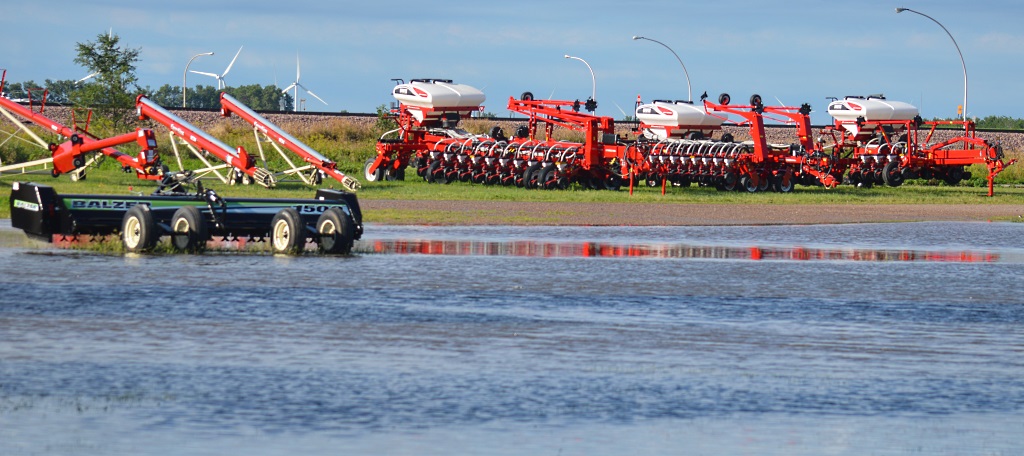
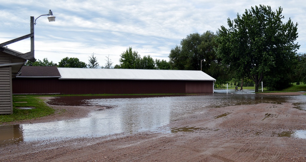
SO, TOO, the red paint of the White planters is caught in the standing water, while a Balzer stalk-chopper, struggles to remain above the fray, in Midway Implement Inc.’s lot on the west edge of Mountain Lake.
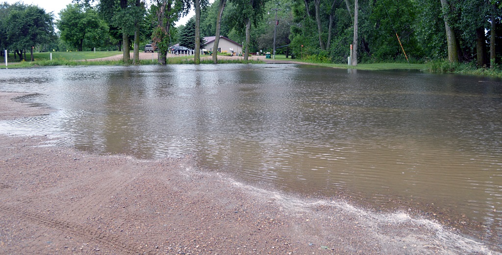
FLOODING WAS ALSO found at the Mountain Lake Golf Course – no parking here – and it took a river crossing to reach the clubhouse.
ANOTHER VIEW AT the golf course, the water depth making it tough to get to the golf cart storage areas.
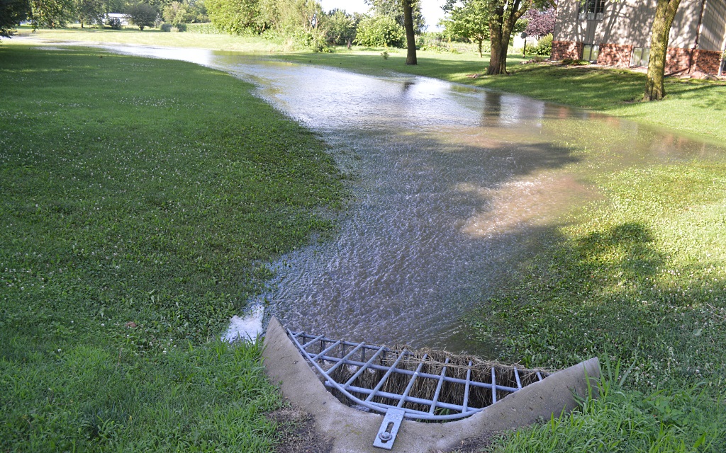
THE CULVERTS WERE wickedly-running, emptying out the results of the overnight heavy rains from the low-lying areas of Mountain Lake; this from a lot east of the home of Clarence and Vivian Blomgren.
ANOTHER FLASH FLOOD “creek” developed east of the home of Ron and Elaine Becker along Boxelder Street, at on the east side of Mountain Lake. The running water emptied through a culvert to the south and under Boxelder to another low-lying property area.
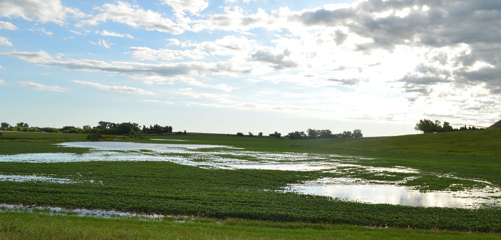
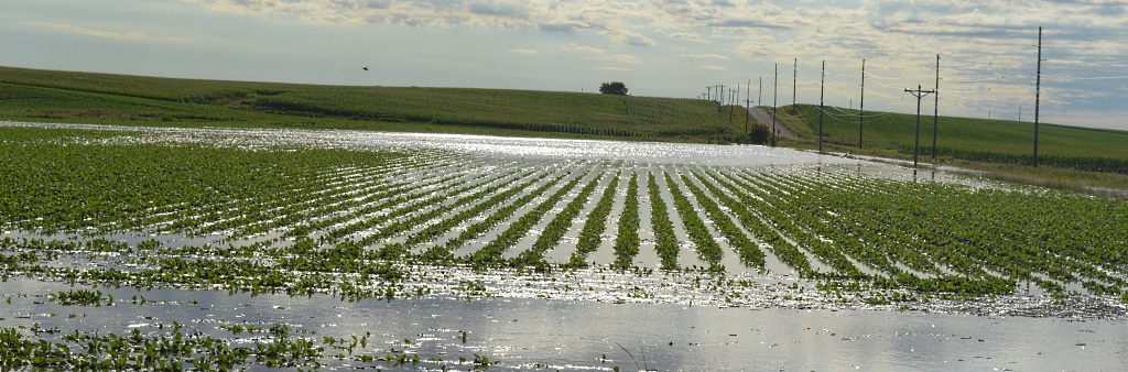
THIS SOYBEAN FIELD on the north Mountain Lake city limits along Cottonwood County Road 29, was momentarily added to Minnesota’s list of 10,000+ lakes following the heavy rains of Saturday night to Sunday morning.
THIS LONE DUCK, however, frolicked in the ground-soaked waters, paddling first one direction – and then another.
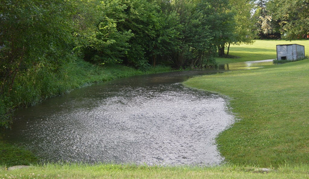
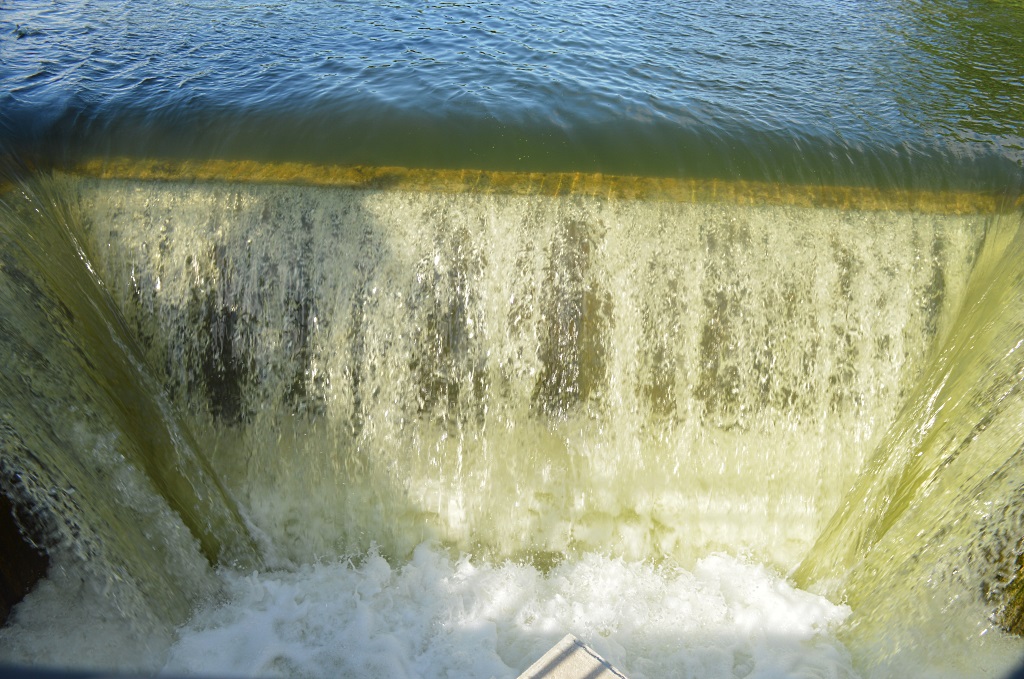
TESTAMENT TO THE amount of rainfall overnight was the two feet of water flowing over the Mountain Lake outlet, churning as the waters combined at its bottom, before emptying out through a creek.
ON THE OTHER side of the lake outlet the water in the creek heads east to eventually empty to the Watonwan River – after it flowed under Cottonwood County Road 29.
FARTHER NORTH ON Cottonwood County Road 29, more farm ground was flooded, each soybean plant struggling to stay above the rain water.
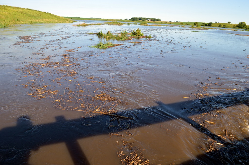
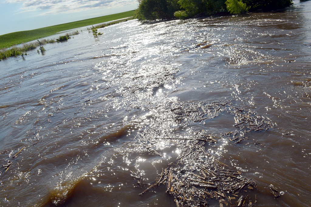
THIS CREEK, north of Mountain Lake on Cottonwood County Road 29, has far overflowed its banks, the rushing water taking with it all types of field and prairie “trash.”
MUCH OF THAT “trash” was found in the form of cornstalks. This creek on Cottonwood County Road 29 swept the water — and everything in it- eastward to also eventually empty into the Watonwan River.